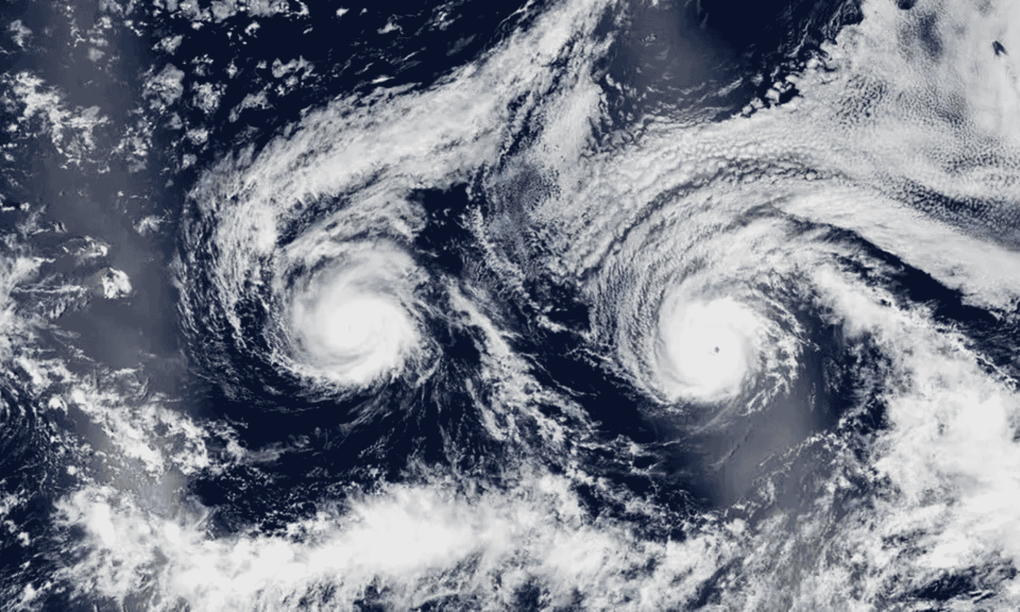
A spectacular satellite image captured over the Pacific Ocean shows two powerful cyclones aligned, forming an eerie smiling face heading towards Hawaii when viewed from above.
Sometimes meteorology plays tricks, or gives spectacular results optical illusions. This is the case of a satellite photo taken from space in August 2016 by the Suomi NPP satellite (Suomi National Polar-orbiting Partnership, the joint mission between NASA and NOAA for climate monitoring). Looking at the Pacific Ocean from above, the cloud formations appear to compose a colossal white face smiling towards the cosmos.
The two “eyes” of the figure were none other than two menacing cyclones: Hurricane Madeline (left) and Hurricane Lester (To the right), both briefly classified as category 4 with winds up to 210 km/h. A classic visual example of pareidolia: that tendency of our brain to identify familiar silhouettes, and especially human faces, in completely random patterns of nature or in inanimate objects.
The invisible shield of the islands
While the “big face” observed the Earth’s orbit, on the ground the concern was real: the two vortices were traveling along the same route a few hundred kilometers from the Big Islandprompting the CPHC (Central Pacific Hurricane Center, the US meteorological center responsible for the central Pacific) to issue a hurricane warning.
Fortunately, neither of them made any real progress landfall (the direct impact of the eye on land). Madeline turned south losing strengthwhile Lester skimmed past Honolulu to the north before dissolving, leaving only strong winds, rain and storm surges on the archipelago. Hawaii is in the cyclone corridor but almost always manages to dodge them thanks to two factors: a constant area of high pressure to the east and intense headwinds that deflect the disturbances.
A natural protection which, between climate change and warming of the Pacific waters, experts fear may not be enough forever.